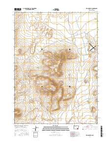
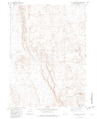
2017 Map of Red Mountain
USGS Topo · Published 2017About this map
Red Mountain dominates the central landscape of this Harney County high-desert terrain, a significant topographical feature rising above the surrounding basin. In the northeast corner, Whitehorse Valley provides a lower-elevation contrast where drainage from Willow Cr feeds into a network of wetlands. This area is characterized by its vital water sources in an otherwise arid environment, marked by geothermal and seasonal features such as Hot Spring, Warm Spring, and the Twin Springs further south. The presence of the Whitehorse Ranch Airport and the traverse of the Whitehorse Ranch Rd highlight the remote infrastructure necessary for ranching operations in this part of Oregon. Water management for livestock or local use is evident through the naming of the Buckskin Reservoir Number Four, illustrating the intersection of natural hydrology and human land use in the Great Basin region.
Find a feature on this map
16 named features on this map. Tap any name to fly to it.
Don’t see what you’re looking for? This feature index may not catch every label — zoom into the map to look around manually.
Map Details
Editions of this 2017 Red Mountain Map
This is the sole edition of this map. No revisions or reprints were ever made.
Other maps of this area

1955 · Adel
USGS Topo · 1:250,000

1957 · Adel
USGS Topo · 1:250,000

1958 · Adel
USGS Topo · 1:250,000

1962 · Adel
USGS Topo · 1:250,000

1981 · Tule Springs
USGS Topo · 1:24,000

1981 · Tule Springs NE
USGS Topo · 1:24,000
1981 · Little Whitehorse Creek
USGS Topo · 1:24,000
1981 · Red Mountain
USGS Topo · 1:24,000
1981 · Coyote Meadows
USGS Topo · 1:24,000
1981 · Red Lookout Butte
USGS Topo · 1:24,000