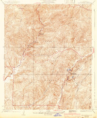
1936 Map of Red Mountain
USGS Topo · Published 1943About this map
The Los Angeles Aqueduct and its accompanying Transmission Line dominate the southern portion of this landscape, illustrating the massive water infrastructure efforts undertaken in Los Angeles County during the early 20th century. This survey documents the critical energy and water corridor through the Angeles National Forest, featuring the San Francisquito Power House No 2 and the Drinkwater Reservoir.
Find a feature on this map
23 named features on this map. Tap any name to fly to it.
Don’t see what you’re looking for? This feature index may not catch every label — zoom into the map to look around manually.
Map Details
Editions of this 1936 Red Mountain Map
4 editions found
Other maps of this area

1900 · Fernando
USGS Topo · 1:62,500

1901 · Southern California Sheet No. 1
USGS Topo · 1:250,000

1903 · Tejon
USGS Topo · 1:125,000

1903 · Camulos
USGS Topo · 1:125,000

1903 · Santa Susana
USGS Topo · 1:62,500

1904 · Southern California Sheet No. 1
USGS Topo · 1:250,000

1915 · Elizabeth Lake
USGS Topo · 1:125,000

1917 · Elizabeth Lake
USGS Topo · 1:125,000

1929 · Saugus
USGS Topo · 1:24,000

1931 · Red Mountain
USGS Topo · 1:24,000