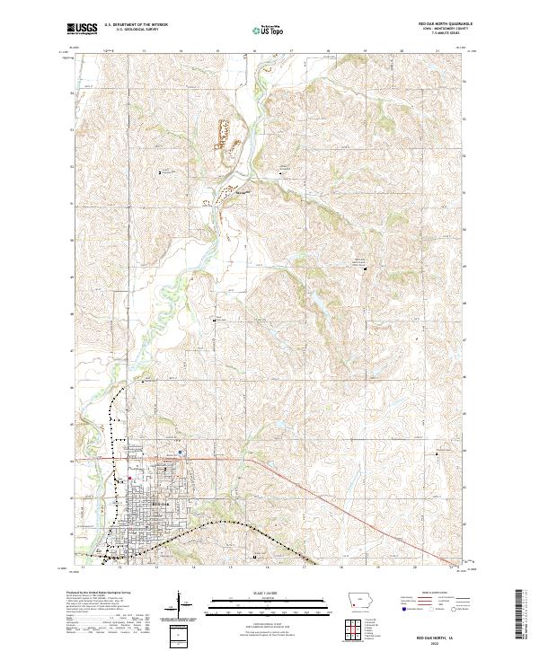
2022 Map of Red Oak North
USGS Topo · Published 2022About this map
Red Oak sits at the southern edge of this survey, where the valley of the East Nishnabotna River meets several small tributaries like Red Oak Cr and Cook Cr. This area of Montgomery County is characterized by a high density of small, often family-linked burial sites scattered across the township lines. Beyond the large Evergreen Cem in town, the map documents several secluded locations, including the Indian Graveyard near Stennett and the specific site of the Mrs Frank Hacffich and Infant Grave. These markers, along with the L Laire Property Cem and Shank Cem, provide significant data for genealogical research in this part of Iowa. The landscape is structured by a grid of rural routes such as Co Hwy M55 and Ratliff Rd, connecting these historic sites to the commercial hub around the Southwestern Community College Red Oak Center.
Find a feature on this map
62 named features on this map. Tap any name to fly to it.
Don’t see what you’re looking for? This feature index may not catch every label — zoom into the map to look around manually.
Map Details
Editions of this 2022 Red Oak North Map
This is the sole edition of this map. No revisions or reprints were ever made.
Other maps of this area

1954 · Omaha
USGS Topo · 1:250,000

1955 · Nebraska City
USGS Topo · 1:250,000

1957 · Nebraska City
USGS Topo · 1:250,000

1957 · Omaha
USGS Topo · 1:250,000

1958 · Omaha
USGS Topo · 1:250,000

1958 · Nebraska City
USGS Topo · 1:250,000

1978 · Stanton
USGS Topo · 1:24,000

1978 · Griswold
USGS Topo · 1:24,000

1978 · Wallin
USGS Topo · 1:24,000

1978 · Wales
USGS Topo · 1:24,000