
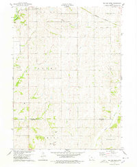
1978 Map of Wallin
USGS Topo · Published 1978About this map
Wallin and its surrounding townships define this agrarian landscape in Montgomery County during the late 1970s. The area is marked by a network of drainage systems, most notably the south-flowing East Tarkio Creek and the Little Tarkio River, which carve through the territory of Frankfort and Pilot Grove. Cultural life is anchored by local congregations and burial grounds, including the Tabor Ch near Wallin and the Pilot Grove Ch and Pilot Grove Cem further north. This topographic study captures the rural infrastructure of the era, from the established sections of Douglas and Washington to the modern utility of industrial pipelines that traverse the township boundaries. Genealogists may find the locations of Mission Cem and Memorial Cem particularly useful for tracing family ties in this corner of southwestern Iowa.
Find a feature on this map
14 named features on this map. Tap any name to fly to it.
Don’t see what you’re looking for? This feature index may not catch every label — zoom into the map to look around manually.
Map Details
Editions of this 1978 Wallin Map
This is the sole edition of this map. No revisions or reprints were ever made.
Other maps of this area

1954 · Omaha
USGS Topo · 1:250,000

1955 · Nebraska City
USGS Topo · 1:250,000

1957 · Nebraska City
USGS Topo · 1:250,000

1957 · Omaha
USGS Topo · 1:250,000

1958 · Omaha
USGS Topo · 1:250,000

1958 · Nebraska City
USGS Topo · 1:250,000

1978 · Stanton
USGS Topo · 1:24,000

1978 · Griswold
USGS Topo · 1:24,000

1978 · Griswold NE
USGS Topo · 1:24,000
1978 · Red Oak South
USGS Topo · 1:24,000