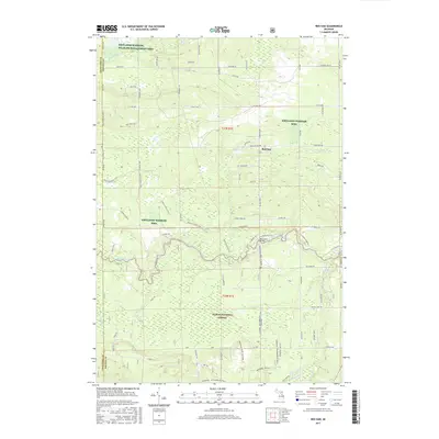
2017 Map of Red Oak
USGS Topo · Published 2017About this map
Kirtlands Warbler Wildlife Management Area and the Huron National Forest dominate this section of Oscoda County, highlighting a landscape dedicated to conservation and public land management. The small settlement of Red Oak sits near the center, serving as a focal point for the surrounding rural roads like Kneeland Rd and N Red Oak Rd. This 2017 survey reveals a complex hydrological network defined by the Au Sable River and its numerous tributaries, including Beaver Cr, Big Cr, and Red Cr. The inclusion of the Shore to Shore Trail underscores the region's importance for long-distance recreation, while local landmarks such as Glenn Lake and various named forest tracks like Tucker Trl provide specific points of interest for those studying the modern character of northern Michigan's protected woodlands.
Find a feature on this map
76 named features on this map. Tap any name to fly to it.
Don’t see what you’re looking for? This feature index may not catch every label — zoom into the map to look around manually.
Map Details
Editions of this 2017 Red Oak Map
This is the sole edition of this map. No revisions or reprints were ever made.
Other maps of this area

1949 · Lewiston
USGS Topo · 1:62,500

1950 · Comstock Hills
USGS Topo · 1:24,000

1950 · Lovells
USGS Topo · 1:24,000

1951 · Comstock Hills
USGS Topo · 1:24,000

1951 · Lovells
USGS Topo · 1:24,000

1954 · Traverse City
USGS Topo · 1:250,000

1955 · Comins
USGS Topo · 1:62,500

1958 · Traverse City
USGS Topo · 1:250,000

1963 · Luzerne
USGS Topo · 1:24,000

1963 · Eldorado
USGS Topo · 1:24,000