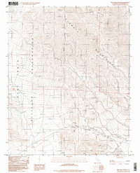
1996 Map of Red Pass Lake NE
USGS Topo · Published 1998About this map
The Avawatz Mountains dominate this high-desert landscape, where the rugged topography is split by the eastern boundary of the Fort Irwin Military Reservation. This 1990s-era survey reveals a terrain defined by historical mineral exploration rather than settlement, with several active or former mining operations concentrated in the southern foothills. Notable features include an Open Pit Mine, Mine Dumps, and an Open Mine, surrounded by scattered Prospect labels and a single unnamed Spring. The presence of an Indefinite Boundary and the restricted military zone suggest a remote area where industrial extraction and government training grounds intersect, leaving the natural desert ridges largely untouched by civilian development.
Find a feature on this map
9 named features on this map. Tap any name to fly to it.
Don’t see what you’re looking for? This feature index may not catch every label — zoom into the map to look around manually.
Map Details
Editions of this 1996 Red Pass Lake NE Map
This is the sole edition of this map. No revisions or reprints were ever made.
Other maps of this area

1933 · Avawatz Mountains
USGS Topo · 1:250,000

1947 · Trona
USGS Topo · 1:250,000

1948 · Red Pass Lake
USGS Topo · 1:62,500

1948 · Trona
USGS Topo · 1:250,000

1948 · Avawatz Pass
USGS Topo · 1:62,500

1951 · Avawatz Pass
USGS Topo · 1:62,500

1951 · Red Pass Lake
USGS Topo · 1:62,500

1953 · Trona
USGS Topo · 1:250,000

1956 · Silurian Hills
USGS Topo · 1:62,500

1956 · Baker
USGS Topo · 1:62,500