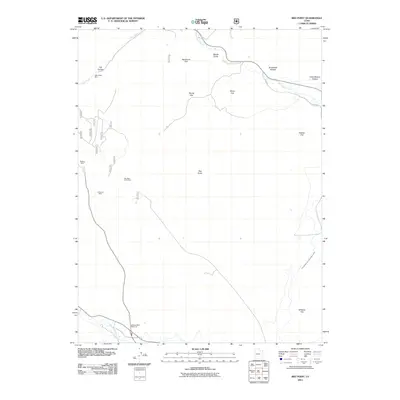
2011 Map of Red Point
USGS Topo · Published 2011About this map
The industrial legacy of Emery County's coal country is defined by the heavy concentration of extractive sites shown here. The Wilberg Mine and the nearby Wilberg Mine Memorial mark a location of significant local historical importance, situated south of other major operations like the Deer Creek Mine, Des-Bee-Dove Mine, and Anderson Mine. This map captures the intersection of industrial development and the natural drainages of Huntington Creek and Deer Creek. High plateau features such as Racehorse Flat, Stump Flat, and Rowley Flat overlook the canyons, while the Cottonwood Creek Huntington Canal reflects the vital role of water management in this arid landscape. Named landmarks like Chris Otteson Hollow and Brockbank Hollow provide specific genealogical reference points for families tied to the canyon's history and the mining industry.
Find a feature on this map
28 named features on this map. Tap any name to fly to it.
Don’t see what you’re looking for? This feature index may not catch every label — zoom into the map to look around manually.
Map Details
Editions of this 2011 Red Point Map
This is the sole edition of this map. No revisions or reprints were ever made.
Other maps of this area

1885 · Manti
USGS Topo · 1:250,000

1886 · Price River
USGS Topo · 1:250,000

1895 · Manti
USGS Topo · 1:250,000

1896 · Price River
USGS Topo · 1:250,000

1923 · Castle Dale
USGS Topo · 1:62,500

1923 · Hiawatha
USGS Topo · 1:62,500

1925 · Castle Dale
USGS Topo · 1:62,500

1925 · Hiawatha
USGS Topo · 1:62,500

1956 · Price
USGS Topo · 1:250,000

1960 · Price
USGS Topo · 1:250,000