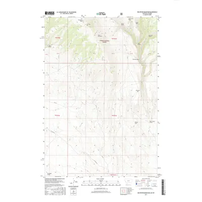
2017 Map of Red Pryor Mountain
USGS Topo · Published 2017About this map
Red Pryor Mtn and the southern reaches of the Pryor Mountains dominate this landscape within the Custer National Forest. The map details a complex system of drainage and relief, where Crooked Cr and Lost Water Cr carve deep through the terrain. Evidence of the area's geological and cultural significance is found in the naming of Petroglyph Canyon in the far southwest corner, while livestock or utility history is suggested by the presence of Commissary Ridge and Commissary Cr. Access to this high-altitude region is limited to primitive routes like Helt Rd and Gyp Springs Rd, which navigate between prominent landmarks such as Penney Peak and Island Ridge. The transition from the high ridges down to Demijohn Flat illustrates the drainage patterns characteristic of the Montana-Wyoming borderlands.
Find a feature on this map
27 named features on this map. Tap any name to fly to it.
Don’t see what you’re looking for? This feature index may not catch every label — zoom into the map to look around manually.
Map Details
Editions of this 2017 Red Pryor Mountain Map
This is the sole edition of this map. No revisions or reprints were ever made.
Other maps of this area

1954 · Billings
USGS Topo · 1:250,000

1955 · Cody
USGS Topo · 1:250,000

1957 · Billings
USGS Topo · 1:250,000

1958 · Billings
USGS Topo · 1:250,000

1958 · Cody
USGS Topo · 1:250,000

1962 · Cody
USGS Topo · 1:250,000

1964 · Big Ice Cave
USGS Topo · 1:24,000

1964 · Red Pryor Mountain
USGS Topo · 1:24,000

1964 · Sykes Spring
USGS Topo · 1:24,000

1964 · East Pryor Mountain
USGS Topo · 1:24,000