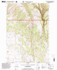
1996 Map of Red Pryor Mountain
USGS Topo · Published 1999About this map
Red Pryor Mountain rises above a high-desert landscape defined by complex drainage systems and isolated mining claims along the Montana-Wyoming border. The 1990s terrain reveals a history of extraction within the Custer National Forest, where a cluster of sites including the Old Glory Mine, Sandra Mine, and The Dandy Mine dot the slopes of Demijohn Hollow. The eastern edge of the map is dominated by the Pryor Mountain Wild Horse Range, which follows the steep breaks of Canyon Creek. Cattle ranching is represented by the Tillett Ranch near Penney Peak, while the network of ephemeral water sources like Gypsum Creek and Red Water Well highlights the arid conditions that shaped human activity in this corner of Carbon County.
Find a feature on this map
26 named features on this map. Tap any name to fly to it.
Don’t see what you’re looking for? This feature index may not catch every label — zoom into the map to look around manually.
Map Details
Editions of this 1996 Red Pryor Mountain Map
This is the sole edition of this map. No revisions or reprints were ever made.
Other maps of this area

1954 · Billings
USGS Topo · 1:250,000

1955 · Cody
USGS Topo · 1:250,000

1957 · Billings
USGS Topo · 1:250,000

1958 · Billings
USGS Topo · 1:250,000

1958 · Cody
USGS Topo · 1:250,000

1962 · Cody
USGS Topo · 1:250,000

1964 · Big Ice Cave
USGS Topo · 1:24,000

1964 · Red Pryor Mountain
USGS Topo · 1:24,000

1964 · Sykes Spring
USGS Topo · 1:24,000

1964 · East Pryor Mountain
USGS Topo · 1:24,000