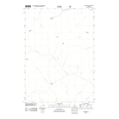
2011 Map of Red Ridge
USGS Topo · Published 2011About this map
Red Ridge and Red Peak dominate this Bonneville County landscape, where a dense network of mountain drainages feeds the regional hydrology. The 2011 survey reveals a territory primarily defined by its topographic extremes, from the heights of Congress Knob to the sheltered expanse of Chaparral Hollow. Human presence is concentrated at specific sites like Camp Ta-Man-a-Wis and Golden Gate, suggesting a landscape utilized for seasonal recreation or specific geographic passage rather than dense residential development.
Find a feature on this map
23 named features on this map. Tap any name to fly to it.
Don’t see what you’re looking for? This feature index may not catch every label — zoom into the map to look around manually.
Map Details
Editions of this 2011 Red Ridge Map
This is the sole edition of this map. No revisions or reprints were ever made.
Other maps of this area

1932 · Irwin
USGS Topo · 1:96,000

1935 · Irwin
USGS Topo · 1:125,000

1955 · Driggs
USGS Topo · 1:250,000

1958 · Driggs
USGS Topo · 1:250,000

1962 · Driggs
USGS Topo · 1:250,000

1966 · Big Elk Mtn
USGS Topo · 1:24,000

1966 · Conant Valley
USGS Topo · 1:24,000
1966 · Thompson Peak
USGS Topo · 1:24,000
1966 · Herman
USGS Topo · 1:24,000
1966 · Commissary Ridge
USGS Topo · 1:24,000