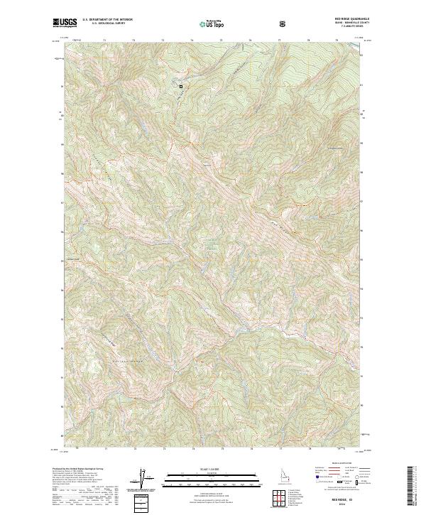
2024 Map of Red Ridge
USGS Topo · Published 2024About this map
The Caribou National Forest dominates this landscape in the Caribou Range, where high-elevation landmarks such as Red Peak and Congress Knob define the local topography. This 2024 survey details an extensive network of back-country routes, including the Deadhorse Ridge Trl and the Fourth Of July/Red Ridge Trl, illustrating the modern management of these public lands.
Find a feature on this map
52 named features on this map. Tap any name to fly to it.
Don’t see what you’re looking for? This feature index may not catch every label — zoom into the map to look around manually.
Map Details
Editions of this 2024 Red Ridge Map
This is the sole edition of this map. No revisions or reprints were ever made.
Other maps of this area

1932 · Irwin
USGS Topo · 1:96,000

1935 · Irwin
USGS Topo · 1:125,000

1955 · Driggs
USGS Topo · 1:250,000

1958 · Driggs
USGS Topo · 1:250,000

1962 · Driggs
USGS Topo · 1:250,000

1966 · Big Elk Mtn
USGS Topo · 1:24,000

1966 · Conant Valley
USGS Topo · 1:24,000
1966 · Thompson Peak
USGS Topo · 1:24,000
1966 · Herman
USGS Topo · 1:24,000
1966 · Commissary Ridge
USGS Topo · 1:24,000