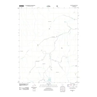
2011 Map of Red Ridge
USGS Topo · Published 2011About this map
Three Creeks Reservoir and the surrounding high country of Sevier County define this high-altitude landscape. The terrain is a complex network of ridges and drainages, where South Mountain and East Mountain flank a series of named valleys like Charlesworth Valley and Bull Valley. Seasonal water sources are critical to this environment, evidenced by labels for Staples Spring, Ferguson Spring, and First Creek Spring. Notable landmarks such as Granddad Peak, The Pyramids, and the curiously named Marys Nipples provide essential orientation points. The map shows the development of limited transportation corridors, specifically Corn Creek Pavhant Rd and Grass Valley Rd, which facilitate access through the drainages of Dog Valley Creek and Skunk Creek.
Find a feature on this map
30 named features on this map. Tap any name to fly to it.
Don’t see what you’re looking for? This feature index may not catch every label — zoom into the map to look around manually.
Map Details
Editions of this 2011 Red Ridge Map
This is the sole edition of this map. No revisions or reprints were ever made.
Other maps of this area

1885 · Beaver
USGS Topo · 1:250,000

1932 · Sevier
USGS Topo · 1:62,500

1935 · Sevier
USGS Topo · 1:62,500

1953 · Richfield
USGS Topo · 1:250,000

1958 · Richfield
USGS Topo · 1:250,000

1962 · Fillmore
USGS Topo · 1:62,500

1962 · Tabernacle Hill
USGS Topo · 1:62,500

1962 · Cove Fort
USGS Topo · 1:62,500
1980 · Joseph Peak
USGS Topo · 1:24,000

1980 · Richfield
USGS Topo · 1:100,000