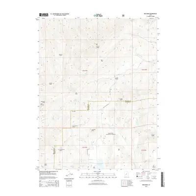
2014 Map of Red Ridge
USGS Topo · Published 2014About this map
Fishlake National Forest dominates the southern reaches of this terrain, where the high elevations of the Pahvant Range meet the complex drainage systems of the central Utah highlands. The boundary between Millard and Sevier Counties bisects the area, cutting across landmarks like Marys Nipples and Bull Valley. Hydrological features are central to the landscape, from the Three Creeks Reservoir in the south to a network of isolated water sources such as Staples Spring, Ferguson Spring, and Red Cedar Spring. The presence of Limekiln Canyon and Dameron Canyon suggests a history of local resource extraction and early land use, while the primitive route of Corn Creek Pahvan Rd provides one of the few managed paths through the high country. Broad basins like Charlesworth Valley contrast with sharp features such as The Pyramids and Granddad Peak, illustrating the varied topography of the range.
Find a feature on this map
44 named features on this map. Tap any name to fly to it.
Don’t see what you’re looking for? This feature index may not catch every label — zoom into the map to look around manually.
Map Details
Editions of this 2014 Red Ridge Map
This is the sole edition of this map. No revisions or reprints were ever made.
Other maps of this area

1885 · Beaver
USGS Topo · 1:250,000

1932 · Sevier
USGS Topo · 1:62,500

1935 · Sevier
USGS Topo · 1:62,500

1953 · Richfield
USGS Topo · 1:250,000

1958 · Richfield
USGS Topo · 1:250,000

1962 · Fillmore
USGS Topo · 1:62,500

1962 · Tabernacle Hill
USGS Topo · 1:62,500

1962 · Cove Fort
USGS Topo · 1:62,500
1980 · Joseph Peak
USGS Topo · 1:24,000

1980 · Richfield
USGS Topo · 1:100,000