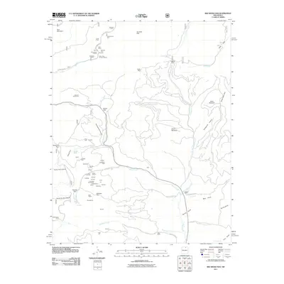
2011 Map of Red River Pass
USGS Topo · Published 2011About this map
The mining history of the Taos Mountains is laid bare across this high-altitude landscape, where numerous claims and prospects dot the canyons and peaks. Operations such as the Bitter Creek Mining Company and the Memphis Mine highlight an era of intensive exploration, with dozens of individually named mines like the Elizabeth Mine, King Yellow Jacket, and Gold King Number Two concentrated near Butcherknife Canyon. This density of named claims indicates a complex web of mineral rights and late-industrial activity that shaped the area's development long after the initial strikes.
Find a feature on this map
78 named features on this map. Tap any name to fly to it.
Don’t see what you’re looking for? This feature index may not catch every label — zoom into the map to look around manually.
Map Details
Editions of this 2011 Red River Pass Map
This is the sole edition of this map. No revisions or reprints were ever made.
Other maps of this area

1954 · Raton
USGS Topo · 1:250,000

1955 · Ute Park
USGS Topo · 1:62,500

1958 · Raton
USGS Topo · 1:250,000

1962 · Ash Mountain
USGS Topo · 1:62,500

1963 · Wheeler Peak
USGS Topo · 1:24,000

1963 · Eagle Nest
USGS Topo · 1:24,000

1963 · Red River Pass
USGS Topo · 1:24,000

1963 · Latir Peak
USGS Topo · 1:24,000

1963 · Comanche Point
USGS Topo · 1:24,000

1963 · Red River
USGS Topo · 1:24,000