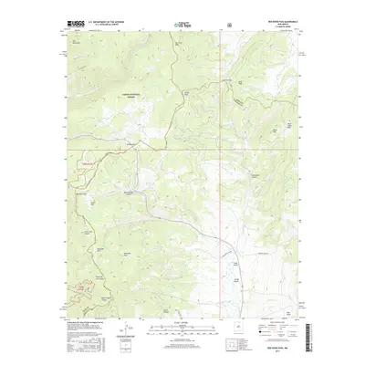
2017 Map of Red River Pass
USGS Topo · Published 2017About this map
Red River Pass and the historic route of the Old Red River Pass dominate this section of the Taos Mountains, where high-altitude transit routes cross the rugged divide between Taos and Colfax counties. The landscape is defined by the high peaks of the Carson National Forest, including Van Diest Peak and Tetilla Peak, which look down upon a series of mountain meadows known as parks. These include Italian Park, Hematite Park, and Kentucky Park, names that suggest the varied ethnic and industrial heritage of those who worked these high basins. The drainage patterns of Comanche Cr, Moreno Cr, and Bitter Cr illustrate the complex watershed of the Sangre de Cristo range, while specialized landmarks like Black Copper Canyon and Butcherknife Canyon hint at the prospecting and local lore of the region's earlier eras.
Find a feature on this map
39 named features on this map. Tap any name to fly to it.
Don’t see what you’re looking for? This feature index may not catch every label — zoom into the map to look around manually.
Map Details
Editions of this 2017 Red River Pass Map
This is the sole edition of this map. No revisions or reprints were ever made.
Other maps of this area

1954 · Raton
USGS Topo · 1:250,000

1955 · Ute Park
USGS Topo · 1:62,500

1958 · Raton
USGS Topo · 1:250,000

1962 · Ash Mountain
USGS Topo · 1:62,500

1963 · Wheeler Peak
USGS Topo · 1:24,000

1963 · Eagle Nest
USGS Topo · 1:24,000

1963 · Red River Pass
USGS Topo · 1:24,000

1963 · Latir Peak
USGS Topo · 1:24,000

1963 · Comanche Point
USGS Topo · 1:24,000

1963 · Red River
USGS Topo · 1:24,000