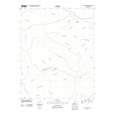
2010 Map of Red River Peak
USGS Topo · Published 2010About this map
Van Houten serves as the primary point of settlement in this landscape of deep drainages and mineral prospects. The area's industrial history is well-documented through a series of operations such as the Van Houten Number One Mine and the Willow Numbers Five and Six Mines, which follow the contours of the rugged canyon walls. Further north, the Standard Graphite Company Prospect and a separate Graphite Prospect indicate the diverse geological interests that drew surveyors and laborers to this part of Colfax County.
Find a feature on this map
43 named features on this map. Tap any name to fly to it.
Don’t see what you’re looking for? This feature index may not catch every label — zoom into the map to look around manually.
Map Details
Editions of this 2010 Red River Peak Map
This is the sole edition of this map. No revisions or reprints were ever made.
Other maps of this area

1912 · Raton
USGS Topo · 1:62,500

1914 · Raton
USGS Topo · 1:62,500

1915 · Brilliant
USGS Topo · 1:62,500

1915 · Koehler
USGS Topo · 1:62,500

1917 · Koehler
USGS Topo · 1:62,500

1954 · Raton
USGS Topo · 1:250,000

1958 · Raton
USGS Topo · 1:250,000

1971 · Clifton House
USGS Topo · 1:24,000

1971 · Saltpeter Mountain
USGS Topo · 1:24,000
1971 · Raton
USGS Topo · 1:24,000