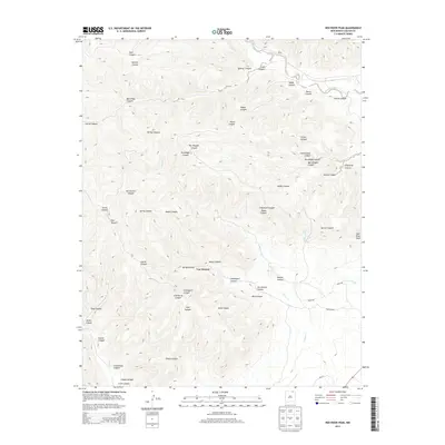
2013 Map of Red River Peak
USGS Topo · Published 2013About this map
Van Houten sits at the heart of this landscape, where the high-altitude drainage systems of Colfax County meet. The topography is defined by a dense network of canyons, many bearing the names of early settlers or local families, such as Mac Dougall Canyon, Schombrug Canyon, and McClellan Canyon. These deep incisions in the earth trace the movement of water toward the Canadian River in the northeast and through several major tributaries including Willow Cr and Falls Cr. The transition from prominent heights like Red River Peak to the more level arroyos to the east reveals a transition in land use, from the timbered and complex relief of Graveyard Canyon to the more accessible roads found further south. This 2013 survey provides a clear look at how rural infrastructure and natural landmarks define this portion of northern New Mexico.
Find a feature on this map
38 named features on this map. Tap any name to fly to it.
Don’t see what you’re looking for? This feature index may not catch every label — zoom into the map to look around manually.
Map Details
Editions of this 2013 Red River Peak Map
This is the sole edition of this map. No revisions or reprints were ever made.
Other maps of this area

1912 · Raton
USGS Topo · 1:62,500

1914 · Raton
USGS Topo · 1:62,500

1915 · Brilliant
USGS Topo · 1:62,500

1915 · Koehler
USGS Topo · 1:62,500

1917 · Koehler
USGS Topo · 1:62,500

1954 · Raton
USGS Topo · 1:250,000

1958 · Raton
USGS Topo · 1:250,000

1971 · Clifton House
USGS Topo · 1:24,000

1971 · Saltpeter Mountain
USGS Topo · 1:24,000
1971 · Raton
USGS Topo · 1:24,000