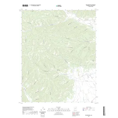
2023 Map of Red River Peak
USGS Topo · Published 2023About this map
Van Houten sits at the nexus of a complex drainage system in this high-altitude landscape of Colfax County. The terrain is defined by a dense network of deeply carved canyons, including the evocative Graveyard Canyon, Van Houten Canyon, and Coal Canyon, many of which feed into the Willow Creek system. To the northeast, the Canadian River cuts across the corner of the sheet, while the prominent Red River Peak dominates the eastern horizon. The road network, including Range Rd and the uniquely named Fund Raising road, suggests a mix of remote land management and localized development. The abundance of named geographic features like Negro Canyon and Schombrug Canyon provides a specific window into the historical naming conventions and land use of this northern New Mexico region during the early twenty-first century.
Find a feature on this map
38 named features on this map. Tap any name to fly to it.
Don’t see what you’re looking for? This feature index may not catch every label — zoom into the map to look around manually.
Map Details
Editions of this 2023 Red River Peak Map
This is the sole edition of this map. No revisions or reprints were ever made.
Other maps of this area

1912 · Raton
USGS Topo · 1:62,500

1914 · Raton
USGS Topo · 1:62,500

1915 · Brilliant
USGS Topo · 1:62,500

1915 · Koehler
USGS Topo · 1:62,500

1917 · Koehler
USGS Topo · 1:62,500

1954 · Raton
USGS Topo · 1:250,000

1958 · Raton
USGS Topo · 1:250,000

1971 · Clifton House
USGS Topo · 1:24,000

1971 · Saltpeter Mountain
USGS Topo · 1:24,000
1971 · Raton
USGS Topo · 1:24,000