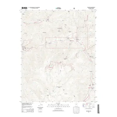
2013 Map of Red River
USGS Topo · Published 2013About this map
Red River is the central hub of this alpine region, situated at the confluence of several mountain drainages within the Carson National Forest. The landscape is defined by the high peaks of the Sangre de Cristo Mountains, including Gold Hill and Relica Peak, which create a complex network of canyons such as Bonito Canyon and Bear Canyon. The town's economy and layout are shaped by its dual identity as a recreation destination and a place of resource extraction, evidenced by the Red River Ski Area and the Moly mining label in Sulphur Gulch. High-altitude water bodies like Goose Lake, Pioneer Lake, and Cabresto Lake dot the wilderness, while numerous campgrounds like Elephant Rock Campground and June Bug Campground trace the banks of the Red River itself. This survey captures the town just as modern infrastructure, including Red River Pass, began to fully integrate these remote mountain settlements into a broader regional network.
Find a feature on this map
57 named features on this map. Tap any name to fly to it.
Don’t see what you’re looking for? This feature index may not catch every label — zoom into the map to look around manually.
Map Details
Editions of this 2013 Red River Map
This is the sole edition of this map. No revisions or reprints were ever made.
Other maps of this area

1954 · Raton
USGS Topo · 1:250,000

1958 · Raton
USGS Topo · 1:250,000

1963 · Wheeler Peak
USGS Topo · 1:24,000

1963 · Eagle Nest
USGS Topo · 1:24,000

1963 · Arroyo Seco
USGS Topo · 1:24,000

1963 · Red River Pass
USGS Topo · 1:24,000

1963 · Cerro
USGS Topo · 1:24,000

1963 · Questa
USGS Topo · 1:24,000

1963 · Latir Peak
USGS Topo · 1:24,000

1963 · Comanche Point
USGS Topo · 1:24,000