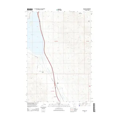
2014 Map of Red Rock
USGS Topo · Published 2014About this map
The Red Rock River defines the valley floor of this Beaverhead County landscape, where the small settlement of Red Rock serves as a focal point along the transport corridor. This 2014 survey captures a moment when modern transit routes parallel the historical path of the Old Armstead Rd, illustrating the continued importance of this passage through the high country. To the northwest, the vast Clark Canyon Reservoir dominates the terrain, fed by the East Fork Clark Canyon.
Find a feature on this map
16 named features on this map. Tap any name to fly to it.
Don’t see what you’re looking for? This feature index may not catch every label — zoom into the map to look around manually.
Map Details
Editions of this 2014 Red Rock Map
This is the sole edition of this map. No revisions or reprints were ever made.
Other maps of this area

1893 · Dillon
USGS Topo · 1:250,000

1952 · Eli Spring
USGS Topo · 1:24,000

1952 · Dalys
USGS Topo · 1:24,000

1952 · Gallagher Mountain
USGS Topo · 1:24,000

1955 · Dubois
USGS Topo · 1:250,000

1955 · Dillon
USGS Topo · 1:250,000

1957 · Dillon
USGS Topo · 1:250,000

1958 · Dubois
USGS Topo · 1:250,000

1958 · Dillon
USGS Topo · 1:250,000

1962 · Dillon
USGS Topo · 1:250,000