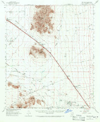
1963 Map of Red Rock
USGS Topo · Published 1971About this map
Picacho Peak and the surrounding Sonoran Desert landscape dominate this survey, centered on the corridor where the Southern Pacific railroad and early highways navigate through Picacho Pass. This desert basin in the early 1960s was a site of significant agricultural and industrial activity, evidenced by the Greene Canal and numerous cattle operations such as La Osa Ranch, Kemper Ranch, and Aguirre Ranch. The map captures a moment of infrastructure development near the Pinal and Pima county line, featuring the Saguaro Power Plant and the sprawling Marana Air Park at the southern edge. Local history is physically anchored at the Mormon Trail Historical Marker 11, while the landscape is defined by the braided channels of McClellan Wash and the Santa Cruz River.
Find a feature on this map
42 named features on this map. Tap any name to fly to it.
Don’t see what you’re looking for? This feature index may not catch every label — zoom into the map to look around manually.
Map Details
Editions of this 1963 Red Rock Map
3 editions found
Other maps of this area

1922 · Red Rock No 2
USGS Topo · 1:48,000

1922 · Signal Peak
USGS Topo · 1:62,500

1924 · Signal Peak
USGS Topo · 1:62,500

1934 · Tucson Mountains
USGS Topo · 1:125,000

1934 · Silver Bell
USGS Topo · 1:125,000

1934 · Newman Peak
USGS Topo · 1:125,000

1947 · Cortaro
USGS Topo · 1:62,500

1947 · Red Rock
USGS Topo · 1:62,500

1947 · Eloy
USGS Topo · 1:62,500

1948 · Eloy
USGS Topo · 1:62,500