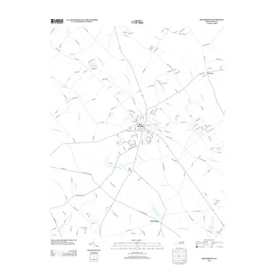
2013 Map of Red Springs
USGS Topo · Published 2013About this map
Red Springs serves as the central hub of this North Carolina landscape, where a dense network of local roads and state routes converges in Robeson County. The town is flanked by a complex system of riparian lowlands, including the broad reaches of Raft Swamp to the northeast and Richland Swamp to the south. This hydrology defines the area's geography, with numerous smaller drainages like Panther Br and McLeans Branch threading between the scattered agricultural settlements.
Find a feature on this map
171 named features on this map. Tap any name to fly to it.
Don’t see what you’re looking for? This feature index may not catch every label — zoom into the map to look around manually.
Map Details
Editions of this 2013 Red Springs Map
This is the sole edition of this map. No revisions or reprints were ever made.
Other maps of this area

1949 · Wagram
USGS Topo · 1:24,000

1949 · Wakulla
USGS Topo · 1:24,000

1949 · Laurinburg
USGS Topo · 1:62,500

1953 · Florence
USGS Topo · 1:250,000

1954 · Florence
USGS Topo · 1:250,000

1972 · Northwest Lumberton
USGS Topo · 1:24,000

1972 · Rennert
USGS Topo · 1:24,000
1972 · Raeford
USGS Topo · 1:24,000

1972 · Pembroke
USGS Topo · 1:24,000
1972 · Parkton
USGS Topo · 1:24,000