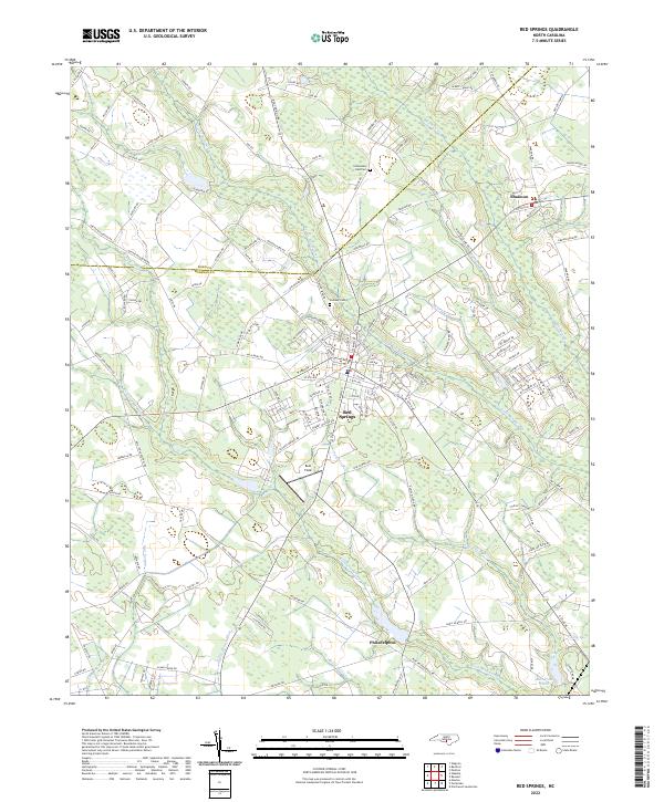
2022 Map of Red Springs
USGS Topo · Published 2022About this map
Red Springs serves as the primary hub in this portion of Robeson County, defined by a dense network of watercourses and swamps that dominate the landscape. The geography is intricately carved by Little Raft Swamp and Raft Swamp, which converge near the town center, while to the south, Richland Swamp and Burnt Swamp create a complex wetland environment. These natural drainage patterns influenced the early placement of local settlements and the winding paths of rural roads like S Old Wire Rd.
Find a feature on this map
142 named features on this map. Tap any name to fly to it.
Don’t see what you’re looking for? This feature index may not catch every label — zoom into the map to look around manually.
Map Details
Editions of this 2022 Red Springs Map
This is the sole edition of this map. No revisions or reprints were ever made.
Other maps of this area

1949 · Wagram
USGS Topo · 1:24,000

1949 · Wakulla
USGS Topo · 1:24,000

1949 · Laurinburg
USGS Topo · 1:62,500

1953 · Florence
USGS Topo · 1:250,000

1954 · Florence
USGS Topo · 1:250,000

1972 · Northwest Lumberton
USGS Topo · 1:24,000

1972 · Rennert
USGS Topo · 1:24,000
1972 · Raeford
USGS Topo · 1:24,000

1972 · Pembroke
USGS Topo · 1:24,000
1972 · Parkton
USGS Topo · 1:24,000