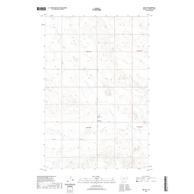
2020 Map of Red Top
USGS Topo · Published 2020About this map
Red Top anchors this rural landscape in Dawson County, where the plains are etched by the winding drainages of Threemile Cr and its northern tributary, N Fork Threemile Cr. The map reveals a sparsely populated section of eastern Montana organized by a grid of rural routes, including RD 523 and RD 532. A significant site for local history and genealogy is the Red Top Mennonite Cem, which stands as a quiet marker of the community's cultural heritage. The terrain is characterized by intricate contouring that defines the breaks and ridges between the creek beds, reflecting the persistent work of water on the high plains. This 2020 survey provides a clear view of the modern layout of sections and townships, such as t19n r54e, showcasing how land divisions continue to shape the geography of this agricultural region.
Find a feature on this map
14 named features on this map. Tap any name to fly to it.
Don’t see what you’re looking for? This feature index may not catch every label — zoom into the map to look around manually.
Map Details
Editions of this 2020 Red Top Map
This is the sole edition of this map. No revisions or reprints were ever made.
Other maps of this area

1909 · Glendive
USGS Topo · 1:250,000

1954 · Glendive
USGS Topo · 1:250,000

1957 · Glendive
USGS Topo · 1:250,000

1958 · Glendive
USGS Topo · 1:250,000

1966 · Kolberg Ranch
USGS Topo · 1:24,000

1966 · Intake NW
USGS Topo · 1:24,000

1972 · Red Top
USGS Topo · 1:24,000

1972 · Butler Table
USGS Topo · 1:24,000

1972 · Morgan Creek School
USGS Topo · 1:24,000

1972 · Clay Butte
USGS Topo · 1:24,000