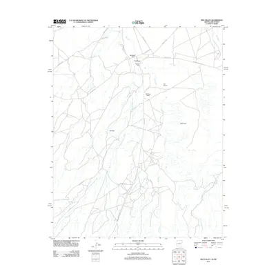
2011 Map of Red Valley
USGS Topo · Published 2011About this map
The Red Rock Trading Post serves as a central landmark in this high-desert region of the Shiprock Agency, situated at the intersection of several tribal routes. The landscape is defined by its dramatic geological formations, including the prominent spire known as The Thumb and the broad Red Rock Valley. The drainage network is particularly intricate here, with the Standing Redrock Creek and Little Shiprock Wash carving through the arid terrain. Significant infrastructure, such as Kerr McGee Rd and Indian Rte 13, reflects the ongoing movement and connectivity within this corner of the Navajo Nation. The presence of Sand Spring and the seasonally active Red Wash highlights the critical role of water sources in this environment, where the topography transitions between named landmarks like White Rock and the red-hued geology that gives the area its name.
Find a feature on this map
23 named features on this map. Tap any name to fly to it.
Don’t see what you’re looking for? This feature index may not catch every label — zoom into the map to look around manually.
Map Details
Editions of this 2011 Red Valley Map
This is the sole edition of this map. No revisions or reprints were ever made.
Other maps of this area

1889 · Chaco
USGS Topo · 1:250,000

1892 · Chaco
USGS Topo · 1:250,000

1892 · Canyon De Chelly
USGS Topo · 1:250,000

1934 · Ship Rock
USGS Topo · 1:62,500

1937 · Ship Rock
USGS Topo · 1:62,500

1953 · Sanostee
USGS Topo · 1:62,500

1953 · Redrock Valley NE
USGS Topo · 1:24,000

1953 · Redrock Valley SE
USGS Topo · 1:24,000

1953 · Redrock Valley SW
USGS Topo · 1:24,000

1953 · Redrock Valley NW
USGS Topo · 1:24,000