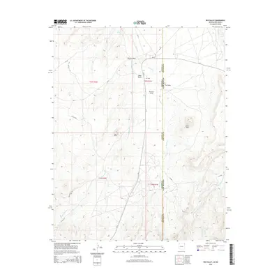
2014 Map of Red Valley
USGS Topo · Published 2014About this map
Red Valley and Red Rock anchor this high-desert landscape situated along the border of Arizona and New Mexico. The geography is defined by a series of significant drainage systems and geological landmarks, including the prominent Red Rock Valley and distinctive formations such as The Thumb and White Rock. Water sources like Sand Spring and Spring provided critical points of interest in an arid environment shaped by the seasonal flows of Red Rock Wash, Salt Wash, and Standing Redrock Cr. The map details a network of Bureau of Indian Affairs routes, such as Bia-13, which connect these settlements across the county lines of Apache and San Juan. Industrial or utility access is noted via the Kerr McGee Rd, suggesting a landscape utilized for more than just residential settlement at the time of this survey.
Find a feature on this map
29 named features on this map. Tap any name to fly to it.
Don’t see what you’re looking for? This feature index may not catch every label — zoom into the map to look around manually.
Map Details
Editions of this 2014 Red Valley Map
This is the sole edition of this map. No revisions or reprints were ever made.
Other maps of this area

1889 · Chaco
USGS Topo · 1:250,000

1892 · Chaco
USGS Topo · 1:250,000

1892 · Canyon De Chelly
USGS Topo · 1:250,000

1934 · Ship Rock
USGS Topo · 1:62,500

1937 · Ship Rock
USGS Topo · 1:62,500

1953 · Sanostee
USGS Topo · 1:62,500

1953 · Redrock Valley NE
USGS Topo · 1:24,000

1953 · Redrock Valley SE
USGS Topo · 1:24,000

1953 · Redrock Valley SW
USGS Topo · 1:24,000

1953 · Redrock Valley NW
USGS Topo · 1:24,000