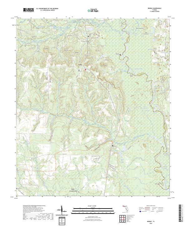
2024 Map of Redbay
USGS Topo · Published 2024About this map
Redbay sits as a central settlement in this Florida panhandle landscape, where the shifting waters of the Choctawhatchee River define the eastern boundary with numerous oxbows and cutoffs. The terrain is characterized by distinct rises such as McKinnon Hill and Mount Hammock, which overlook a complex network of wetlands and ponds including Endless Lake and Lassiter Lake. Local genealogy and heritage are deeply rooted here, evidenced by several family and community burial grounds like the Sam Story Burial Site, Batson Family Cem, and Jenkins Family Cem. The southern portion of the quadrangle features the Battle Ground Forks and the winding path of the Florida National Scenic Trl, which follows the contours of Seven Runs and Black Creek. This modern survey highlights how historical settlement patterns remain anchored to the elevated ridges and creek valleys above the river's floodplains.
Find a feature on this map
92 named features on this map. Tap any name to fly to it.
Don’t see what you’re looking for? This feature index may not catch every label — zoom into the map to look around manually.
Map Details
Editions of this 2024 Redbay Map
This is the sole edition of this map. No revisions or reprints were ever made.
Other maps of this area

1935 · De Funiak Springs
USGS Topo · 1:48,000

1936 · Point Washington
USGS Topo · 1:48,000

1938 · De Funiak Springs
USGS Topo · 1:62,500

1939 · Point Washington
USGS Topo · 1:62,500

1944 · Bruce
USGS Topo · 1:24,000

1945 · Red Head
USGS Topo · 1:31,680

1945 · Bruce
USGS Topo · 1:31,680

1948 · Ponce De Leon
USGS Topo · 1:24,000

1949 · Millers Ferry
USGS Topo · 1:24,000

1949 · Redbay
USGS Topo · 1:24,000