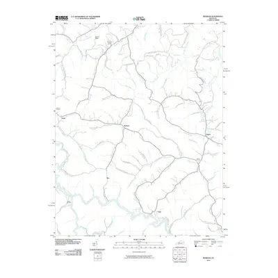
2010 Map of Redbush
USGS Topo · Published 2010About this map
The Martha Pool Gas and Oil Field defines the northern reaches of this rural Kentucky landscape, situated near Martha Ridge. The area is characterized by a dense network of branches and forks that feed into major waterways like Paint Creek and Upper Laurel Creek. Small settlements including Redbush, Elna, and Flatgap are connected by a winding system of local roads that follow the valley floors, such as Patoker Rd and Mudlick Creek Rd. For genealogists, the map preserves the locations of several family-named landmarks and burial grounds, including Cold Iron Cemetery, Jenkins Cemetery, and Salyers Cemetery. The terrain is deeply incised, with many roads named for the specific branches they parallel, such as Gamble Branch Rd and Stapleton Branch Rd, illustrating the traditional valley-bottom settlement pattern of the region.
Find a feature on this map
87 named features on this map. Tap any name to fly to it.
Don’t see what you’re looking for? This feature index may not catch every label — zoom into the map to look around manually.
Map Details
Editions of this 2010 Redbush Map
This is the sole edition of this map. No revisions or reprints were ever made.
Other maps of this area

1886 · Prestonsburg
USGS Topo · 1:125,000

1889 · Salyersville
USGS Topo · 1:125,000

1891 · Salyersville
USGS Topo · 1:125,000

1892 · Prestonsburg
USGS Topo · 1:125,000

1899 · Salyersville
USGS Topo · 1:125,000

1903 · Kenova
USGS Topo · 1:125,000

1904 · Kenova
USGS Topo · 1:125,000

1915 · Paintsville
USGS Topo · 1:48,000

1917 · Paintsville
USGS Topo · 1:62,500

1950 · Isonville
USGS Topo · 1:24,000