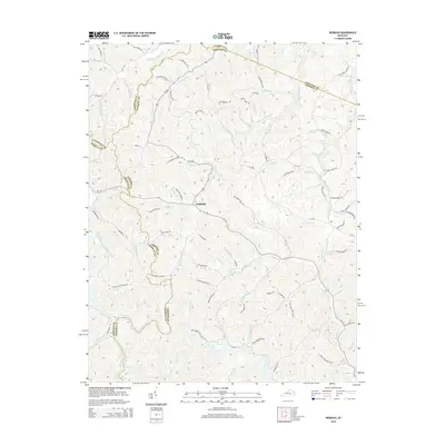
2014 Map of Redbush
USGS Topo · Published 2014About this map
The settlement of Redbush serves as the central point for this 2014 survey, where the borders of Johnson, Lawrence, and Morgan counties converge in a landscape of narrow hollows and winding creeks. The terrain is defined by the headwaters of the Blaine Creek and Paint Creek systems, with Left Fork Blaine Cr and Keaton Fork draining the northern slopes. This map captures the modern road network, including KY 172 and KY 469, which follow the natural contours of the stream valleys. Local history is preserved in named landmarks like the Hamilton Cemetery and family-identified geography such as Skaggs Ridge and Fraley Hollow. The density of named branches and forks, from Gillum Br to Salyer Br, illustrates how early settlement patterns were dictated by the complex drainage of the Cumberland Plateau.
Find a feature on this map
103 named features on this map. Tap any name to fly to it.
Don’t see what you’re looking for? This feature index may not catch every label — zoom into the map to look around manually.
Map Details
Editions of this 2014 Redbush Map
This is the sole edition of this map. No revisions or reprints were ever made.
Other maps of this area

1886 · Prestonsburg
USGS Topo · 1:125,000

1889 · Salyersville
USGS Topo · 1:125,000

1891 · Salyersville
USGS Topo · 1:125,000

1892 · Prestonsburg
USGS Topo · 1:125,000

1899 · Salyersville
USGS Topo · 1:125,000

1903 · Kenova
USGS Topo · 1:125,000

1904 · Kenova
USGS Topo · 1:125,000

1915 · Paintsville
USGS Topo · 1:48,000

1917 · Paintsville
USGS Topo · 1:62,500

1950 · Isonville
USGS Topo · 1:24,000