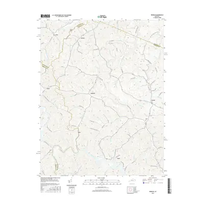
2016 Map of Redbush
USGS Topo · Published 2016About this map
Patterson Creek and its many winding tributaries define the landscape of this eastern Kentucky region, where the borders of Lawrence, Johnson, and Morgan counties converge. Small settlements are situated throughout the narrow valleys and along ridgelines, including Redbush, Flatgap, and Keaton. The topography is characterized by high, narrow divides such as Martha Ridge and deeply incised hollows that dictate the path of local travel along routes like Old Terryville Rd and Paint Cliff Church Rd. Evidence of the area's rural social fabric is found in the placement of the Salyers Cem near Flatgap and the Jenkins Cem in the southwestern corner. The complex network of watercourses, including Left Fork Blaine Cr and Meadow Br, illustrates a land deeply connected to its drainage patterns, where nearly every branch and fork is named for its historical use or local families.
Find a feature on this map
111 named features on this map. Tap any name to fly to it.
Don’t see what you’re looking for? This feature index may not catch every label — zoom into the map to look around manually.
Map Details
Editions of this 2016 Redbush Map
This is the sole edition of this map. No revisions or reprints were ever made.
Other maps of this area

1886 · Prestonsburg
USGS Topo · 1:125,000

1889 · Salyersville
USGS Topo · 1:125,000

1891 · Salyersville
USGS Topo · 1:125,000

1892 · Prestonsburg
USGS Topo · 1:125,000

1899 · Salyersville
USGS Topo · 1:125,000

1903 · Kenova
USGS Topo · 1:125,000

1904 · Kenova
USGS Topo · 1:125,000

1915 · Paintsville
USGS Topo · 1:48,000

1917 · Paintsville
USGS Topo · 1:62,500

1950 · Isonville
USGS Topo · 1:24,000