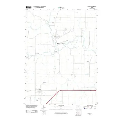
2010 Map of Redfield
USGS Topo · Published 2010About this map
Redfield sits at the confluence of the Middle Raccoon River and Mosquito Creek, serving as a central hub in this landscape of river valleys and agricultural grids. The map reveals a high density of rural burial sites, including Harper Cemetery, East Linn Cemetery, and Pleasant Hill Cemetery, providing valuable data for genealogical researchers tracking early families in the area. To the south, Dexter is positioned along the major transportation corridor, while the small settlement of Wiscotta remains tied to the river at the Wiscotta Bridge.
Find a feature on this map
59 named features on this map. Tap any name to fly to it.
Don’t see what you’re looking for? This feature index may not catch every label — zoom into the map to look around manually.
Map Details
Editions of this 2010 Redfield Map
This is the sole edition of this map. No revisions or reprints were ever made.
Other maps of this area

1949 · Adel
USGS Topo · 1:62,500

1951 · Adel
USGS Topo · 1:62,500

1952 · Panora
USGS Topo · 1:62,500

1952 · Winterset
USGS Topo · 1:62,500

1954 · Greenfield
USGS Topo · 1:62,500

1954 · Omaha
USGS Topo · 1:250,000

1957 · Omaha
USGS Topo · 1:250,000

1958 · Omaha
USGS Topo · 1:250,000
1982 · Panther
USGS Topo · 1:24,000

1982 · Panora
USGS Topo · 1:24,000