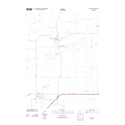
2013 Map of Redfield
USGS Topo · Published 2013About this map
The Middle Raccoon River and S Raccoon River converge near the town of Redfield, shaping a landscape defined by waterway junctions and valley roads. This 2013 survey illustrates a rural Iowa geography where the historic settlement of Wiscotta sits just east of the river bends, while the town of Dexter anchors the southwestern corner along the southern rail and highway corridor.
Find a feature on this map
87 named features on this map. Tap any name to fly to it.
Don’t see what you’re looking for? This feature index may not catch every label — zoom into the map to look around manually.
Map Details
Editions of this 2013 Redfield Map
This is the sole edition of this map. No revisions or reprints were ever made.
Other maps of this area

1949 · Adel
USGS Topo · 1:62,500

1951 · Adel
USGS Topo · 1:62,500

1952 · Panora
USGS Topo · 1:62,500

1952 · Winterset
USGS Topo · 1:62,500

1954 · Greenfield
USGS Topo · 1:62,500

1954 · Omaha
USGS Topo · 1:250,000

1957 · Omaha
USGS Topo · 1:250,000

1958 · Omaha
USGS Topo · 1:250,000
1982 · Panther
USGS Topo · 1:24,000

1982 · Panora
USGS Topo · 1:24,000