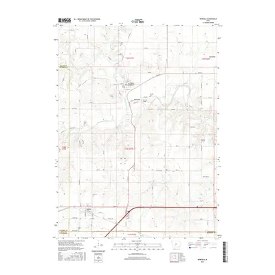
2015 Map of Redfield
USGS Topo · Published 2015About this map
The confluence of the Middle Raccoon River and South Raccoon River anchors this central Iowa landscape, where the settlement of Redfield sits at the junction of several county routes and local roads. This area reflects a deep-rooted agricultural and civic history, evidenced by the numerous burial grounds distributed throughout the township, including the East Linn Cem, Harper Cem, and Spillers Cem. Just to the south, the village of Wiscotta is situated near the Wiscotta Bridge and its namesake Wiscotta Cem, representing an early pocket of development along the riverbanks.
Find a feature on this map
79 named features on this map. Tap any name to fly to it.
Don’t see what you’re looking for? This feature index may not catch every label — zoom into the map to look around manually.
Map Details
Editions of this 2015 Redfield Map
This is the sole edition of this map. No revisions or reprints were ever made.
Other maps of this area

1949 · Adel
USGS Topo · 1:62,500

1951 · Adel
USGS Topo · 1:62,500

1952 · Panora
USGS Topo · 1:62,500

1952 · Winterset
USGS Topo · 1:62,500

1954 · Greenfield
USGS Topo · 1:62,500

1954 · Omaha
USGS Topo · 1:250,000

1957 · Omaha
USGS Topo · 1:250,000

1958 · Omaha
USGS Topo · 1:250,000
1982 · Panther
USGS Topo · 1:24,000

1982 · Panora
USGS Topo · 1:24,000