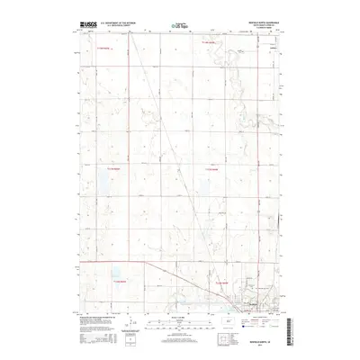
2015 Map of Redfield North
USGS Topo · Published 2015About this map
Redfield and the smaller settlement of Ashton define this Spink County landscape, where the prairie grid of the Public Land Survey System meets the meandering course of Snake Cr. The northern edge of Redfield shows a planned layout near the shores of Lake Redfield, while the surrounding township remains dedicated to agriculture. Genealogists will find several significant burial sites, including Saint Bernard Cem and Greenlawn Cem on the outskirts of the larger town, and Ashton Cem located further north. This 2015 survey provides a modern view of the regional infrastructure, from the primary corridor of 386th Ave to more remote paths like Turtle Ln near Mud Lake. The map details the transition between established municipal centers and the water-carved depressions characteristic of this part of South Dakota.
Find a feature on this map
43 named features on this map. Tap any name to fly to it.
Don’t see what you’re looking for? This feature index may not catch every label — zoom into the map to look around manually.
Map Details
Editions of this 2015 Redfield North Map
This is the sole edition of this map. No revisions or reprints were ever made.
Other maps of this area

1895 · Byron
USGS Topo · 1:125,000

1895 · Aberdeen
USGS Topo · 1:125,000

1899 · Northville
USGS Topo · 1:125,000

1899 · Redfield
USGS Topo · 1:125,000

1953 · Redfield North
USGS Topo · 1:24,000

1953 · Gallup
USGS Topo · 1:24,000

1953 · Ashton
USGS Topo · 1:24,000

1953 · Huron
USGS Topo · 1:250,000

1954 · Aberdeen
USGS Topo · 1:250,000

1954 · Huron
USGS Topo · 1:250,000