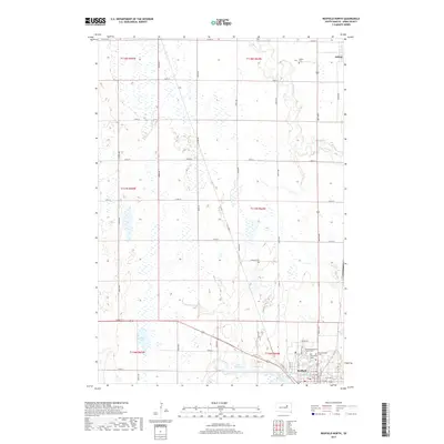
2017 Map of Redfield North
USGS Topo · Published 2017About this map
Redfield and the smaller community of Ashton anchor this Spink County landscape, where the prairie transitions into the drainage basins of Snake Cr and Turtle Creek. The map documents a concentration of institutional and community landmarks on the northern edge of Redfield, including the SD Developmental Center Cem, Greenlawn Cem, and Saint Bernard Cem. These sites, along with Ashton Cem to the north, provide significant points of interest for genealogical research and local history.
Find a feature on this map
48 named features on this map. Tap any name to fly to it.
Don’t see what you’re looking for? This feature index may not catch every label — zoom into the map to look around manually.
Map Details
Editions of this 2017 Redfield North Map
This is the sole edition of this map. No revisions or reprints were ever made.
Other maps of this area

1895 · Byron
USGS Topo · 1:125,000

1895 · Aberdeen
USGS Topo · 1:125,000

1899 · Northville
USGS Topo · 1:125,000

1899 · Redfield
USGS Topo · 1:125,000

1953 · Redfield North
USGS Topo · 1:24,000

1953 · Gallup
USGS Topo · 1:24,000

1953 · Ashton
USGS Topo · 1:24,000

1953 · Huron
USGS Topo · 1:250,000

1954 · Aberdeen
USGS Topo · 1:250,000

1954 · Huron
USGS Topo · 1:250,000