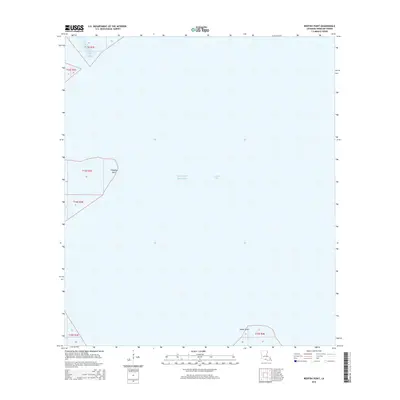
2015 Map of Redfish Point
USGS Topo · Published 2015About this map
Vermilion Bay meets the open waters of the Gulf of Mexico along this coastal stretch of Louisiana, where land and water merge into a complex tidal environment. The landscape is defined by its strategic points, specifically Redfish Point and Indian Point, which mark the transitions between the protected bay and the gulf. Narrow waterways such as the Fourmile Cutoff provide essential navigation channels through the shifting coastal marshes. This 2015 survey reflects a dynamic shoreline primarily shaped by natural hydrology rather than human settlement, serving as a vital reference for researchers monitoring coastal change and marine boundaries in the western Gulf region.
Find a feature on this map
8 named features on this map. Tap any name to fly to it.
Don’t see what you’re looking for? This feature index may not catch every label — zoom into the map to look around manually.
Map Details
Editions of this 2015 Redfish Point Map
This is the sole edition of this map. No revisions or reprints were ever made.
Other maps of this area

1932 · Abbeville SW
USGS Topo · 1:31,680

1932 · Abbeville SE
USGS Topo · 1:31,680

1937 · Derouen
USGS Topo · 1:62,500

1945 · New Orleans
USGS Topo · 1:250,000

1946 · Redfish Point SW
USGS Topo · 1:31,680

1946 · Redfish Point NE
USGS Topo · 1:31,680

1946 · Redfish Point SE
USGS Topo · 1:31,680

1946 · Redfish Point NW
USGS Topo · 1:31,680

1948 · Cypremort Point
USGS Topo · 1:24,000

1949 · Bayou Lucien
USGS Topo · 1:31,680