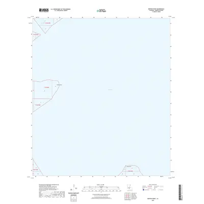
2020 Map of Redfish Point
USGS Topo · Published 2020About this map
Vermilion Bay dominates this coastal landscape, revealing the intricate meeting point of water and marshland in southern Louisiana. This survey highlights the physical geography of the parish's shoreline at the start of the 2020s, showing the precise finger-like protrusions of Redfish Point and Indian Point as they extend into the bay. The presence of the Four Mile Cutoff in the northwest corner suggests the engineering efforts taken to manage water flow and navigation through these wetlands. Without roads or settlements, the map provides a clean study of the Public Land Survey System grid, including townships t15s r3e, t16s r3e, and t16s r4e, which define the legal boundaries of this largely aquatic environment.
Find a feature on this map
7 named features on this map. Tap any name to fly to it.
Don’t see what you’re looking for? This feature index may not catch every label — zoom into the map to look around manually.
Map Details
Editions of this 2020 Redfish Point Map
This is the sole edition of this map. No revisions or reprints were ever made.
Other maps of this area

1932 · Abbeville SW
USGS Topo · 1:31,680

1932 · Abbeville SE
USGS Topo · 1:31,680

1937 · Derouen
USGS Topo · 1:62,500

1945 · New Orleans
USGS Topo · 1:250,000

1946 · Redfish Point SW
USGS Topo · 1:31,680

1946 · Redfish Point NE
USGS Topo · 1:31,680

1946 · Redfish Point SE
USGS Topo · 1:31,680

1946 · Redfish Point NW
USGS Topo · 1:31,680

1948 · Cypremort Point
USGS Topo · 1:24,000

1949 · Bayou Lucien
USGS Topo · 1:31,680