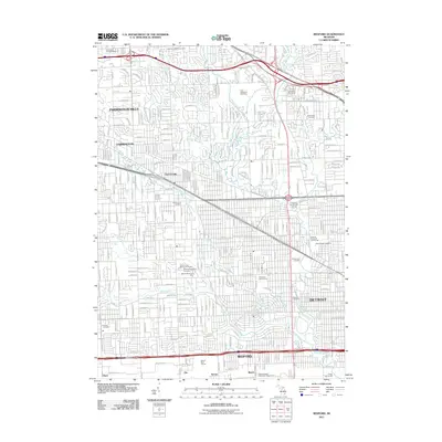
2011 Map of Redford
USGS Topo · Published 2011About this map
Detroit and its western suburbs appear here as a densely patterned landscape of residential grids and arterial roads during the early 21st century. The map illustrates the transition from the city's edge into Redford, Farmington, and Farmington Hills, a region shaped by major thoroughfares like 7 Mile Rd and Schoolcraft Rd. This suburban expanse is punctuated by significant green spaces and memorial grounds, including the sprawling Holy Sepulchre Cemetery and Grand Lawn Cemetery. Drainage systems such as the Upper River Rouge, Bell Branch, and Tarabusi Creek carve through the development, indicating the natural hydrology that persisted beneath the expanding metropolitan footprint. Local leisure and industry are noted by the Detroit Race Course and several community hubs like Glenhurst Golf Course, reflecting the recreational character of these neighborhoods at this point in Michigan's history.
Find a feature on this map
42 named features on this map. Tap any name to fly to it.
Don’t see what you’re looking for? This feature index may not catch every label — zoom into the map to look around manually.
Map Details
Editions of this 2011 Redford Map
This is the sole edition of this map. No revisions or reprints were ever made.
Other maps of this area

1905 · Wayne
USGS Topo · 1:62,500

1905 · Detroit
USGS Topo · 1:62,500

1907 · Pontiac
USGS Topo · 1:62,500

1908 · Rochester
USGS Topo · 1:62,500

1912 · Wayne
USGS Topo · 1:62,500

1918 · Detroit
USGS Topo · 1:62,500

1924 · Detroit
USGS Topo · 1:62,500

1934 · Detroit
USGS Topo · 1:62,500

1936 · Inkster
USGS Topo · 1:31,680

1936 · Wayne
USGS Topo · 1:31,680