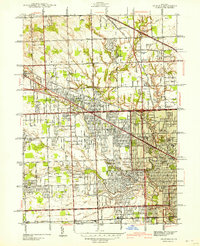
1942 Map of Redford
USGS Topo · Published 1942About this map
The River Rouge and its winding tributaries, including the Bell Branch and Tarabusi Creek, anchor this detailed look at Northwest Detroit and its surrounding suburbs during the early 1940s. The landscape reflects a transitional period where established farming communities like Farmington and Clarenceville met the expanding grid of the city. A high concentration of educational and charitable institutions is evident, from the Childrens Hospital Convalescent Home to numerous local schools like Hettie Bristol Sch and John Grace Sch.
Find a feature on this map
89 named features on this map. Tap any name to fly to it.
Don’t see what you’re looking for? This feature index may not catch every label — zoom into the map to look around manually.
Map Details
Editions of this 1942 Redford Map
2 editions found
Other maps of this area

1905 · Wayne
USGS Topo · 1:62,500

1905 · Detroit
USGS Topo · 1:62,500

1907 · Pontiac
USGS Topo · 1:62,500

1908 · Rochester
USGS Topo · 1:62,500

1912 · Wayne
USGS Topo · 1:62,500

1918 · Detroit
USGS Topo · 1:62,500

1924 · Detroit
USGS Topo · 1:62,500

1934 · Detroit
USGS Topo · 1:62,500

1936 · Inkster
USGS Topo · 1:31,680

1936 · Wayne
USGS Topo · 1:31,680