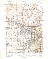
1942 Map of Redford
USGS Topo · Published 1942About this map
Rouge River headwaters and the Upper Rouge River define this 1942 landscape as suburban expansion begins to press into the townships of Farmington, Southfield, and Livonia. The map captures a moment when large institutional properties and recreation clubs still occupied significant tracts, from the Childrens Hospital Convalescent Home and St Paul Monastery to the Kemba Gun Club. This era shows a distinctive grid of arterial roads, including the Northwestern Hy and Grand River Ave, cutting across rural drainage systems like Tarabusi Creek and Bell Branch.
Find a feature on this map
88 named features on this map. Tap any name to fly to it.
Don’t see what you’re looking for? This feature index may not catch every label — zoom into the map to look around manually.
Map Details
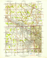
Editions of this 1942 Redford Map
2 editions found
Other maps of this area

1905 · Wayne
USGS Topo · 1:62,500

1905 · Detroit
USGS Topo · 1:62,500

1907 · Pontiac
USGS Topo · 1:62,500

1908 · Rochester
USGS Topo · 1:62,500

1912 · Wayne
USGS Topo · 1:62,500

1918 · Detroit
USGS Topo · 1:62,500

1924 · Detroit
USGS Topo · 1:62,500

1934 · Detroit
USGS Topo · 1:62,500

1936 · Inkster
USGS Topo · 1:31,680

1936 · Wayne
USGS Topo · 1:31,680