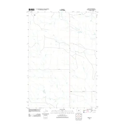
2012 Map of Redig
USGS Topo · Published 2012About this map
The settlement of Redig serves as the focal point for this section of Harding County, situated near the intersection of several local routes. The landscape is defined by the drainage systems of the N Fork Moreau River and its various tributaries, including Snake Cr and Sand Cr. These waterways create a network across the prairie, with Saddle Butte providing a prominent elevation marker in the northwestern corner of the quadrangle. Local transportation is facilitated by thoroughfares such as Limpert Rd and Dillon Rd. For those researching local family history, the Redig Cem is a significant landmark located just east of the main settlement. The distribution of these features illustrates a dispersed ranching or farming community centered around the essential water sources and the primary crossroads at Redig.
Find a feature on this map
12 named features on this map. Tap any name to fly to it.
Don’t see what you’re looking for? This feature index may not catch every label — zoom into the map to look around manually.
Map Details
Editions of this 2012 Redig Map
This is the sole edition of this map. No revisions or reprints were ever made.
Other maps of this area

1935 · Hoover
USGS Topo · 1:125,000

1935 · Harding
USGS Topo · 1:125,000

1954 · Lemmon
USGS Topo · 1:250,000

1957 · Lemmon
USGS Topo · 1:250,000

1973 · Lone Tree Draw East
USGS Topo · 1:24,000

1973 · Lone Tree Draw West
USGS Topo · 1:24,000

1973 · Bog Creek
USGS Topo · 1:24,000

1973 · Redig
USGS Topo · 1:24,000
1978 · Redig NE
USGS Topo · 1:24,000
1978 · Bams Butte NW
USGS Topo · 1:24,000