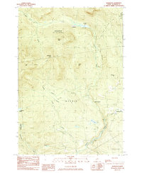
1984 Map of Redington
USGS Topo · Published 1985About this map
Orbeton Stream and its numerous tributaries, including Winship Stream and Hardy Stream, carve through this mountainous portion of Madrid and Phillips. The 1980s landscape is defined by the high peaks of Saddleback Junior, The Horn, and Potato Hill, which are traversed by the Appalachian National Scenic Trail. The map reveals the area's transition from a rail-dependent economy to a managed forest landscape, evidenced by the prominent Old RR Grade winding alongside the water towards Perham Junction. Small settlements like East Madrid and Reeds are shown during a period of relative isolation, connected by a network of unimproved roads and four-wheel-drive tracks. Genealogists may find interest in the Cem located near Perham, while the presence of Redington and the surrounding Redington Township illustrates the complex land divisions of this region.
Find a feature on this map
28 named features on this map. Tap any name to fly to it.
Don’t see what you’re looking for? This feature index may not catch every label — zoom into the map to look around manually.
Map Details
Editions of this 1984 Redington Map
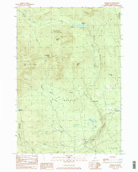
2 editions found
Other maps of this area

1928 · Stratton
USGS Topo · 1:48,000

1929 · Phillips
USGS Topo · 1:48,000

1932 · Phillips
USGS Topo · 1:62,500

1932 · Stratton
USGS Topo · 1:62,500

1932 · Kennebago Lake
USGS Topo · 1:48,000

1933 · Rangeley
USGS Topo · 1:48,000

1935 · Kennebago Lake
USGS Topo · 1:62,500

1936 · Kennebago Lake
USGS Topo · 1:62,500

1939 · Rangeley
USGS Topo · 1:62,500

1949 · Jackman
USGS Topo · 1:250,000
Featured Places
- Phillips, ME
- Madrid Township, ME
- Sandy River Plantation, ME
- East Madrid, Madrid Township
- Mount Abram Township, ME