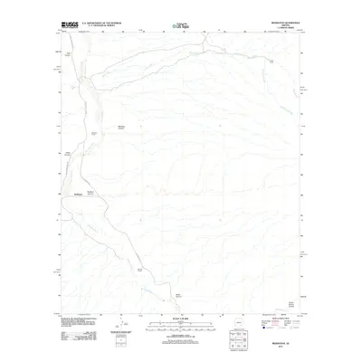
2011 Map of Redington
USGS Topo · Published 2011About this map
The San Pedro River corridor serves as the primary artery for settlement in this Pima County landscape, where the small community of Redington sits at the junction of N Cascabel Rd and the river valley. The settlement pattern is defined by traditional western land use, with notable family holdings such as Bingham Ranch and Bayless Ranch positioned near the water source. These ranching outposts provide crucial reference points for local genealogy and land-use history in a region where water availability dictates human activity.
Find a feature on this map
16 named features on this map. Tap any name to fly to it.
Don’t see what you’re looking for? This feature index may not catch every label — zoom into the map to look around manually.
Map Details
Editions of this 2011 Redington Map
This is the sole edition of this map. No revisions or reprints were ever made.
Other maps of this area

1904 · Tucson
USGS Topo · 1:125,000

1905 · Tucson
USGS Topo · 1:125,000

1911 · Winkelman
USGS Topo · 1:125,000

1913 · Winkelman
USGS Topo · 1:125,000

1938 · Galiuro Mts
USGS Topo · 1:48,000

1943 · Galiuro Mts
USGS Topo · 1:62,500

1945 · Redington
USGS Topo · 1:62,500

1948 · Mammoth
USGS Topo · 1:62,500

1948 · Peppersauce Wash
USGS Topo · 1:24,000
1949 · Peppersauce Wash
USGS Topo · 1:24,000