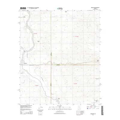
2014 Map of Redington
USGS Topo · Published 2014About this map
Redington is positioned along the western banks of the San Pedro River, serving as a primary point of reference in this arid valley where Pima, Graham, and Cochise counties converge. The settlement is anchored by a network of rural routes, including the N Benson-Mammoth Hwy and N Redington Rd, which facilitate movement through the basin. The landscape is defined by a series of significant drainage systems that carve through the desert floor, most notably the wide expanse of Redfield Canyon and the northern reaches of Bollen Wash.
Find a feature on this map
24 named features on this map. Tap any name to fly to it.
Don’t see what you’re looking for? This feature index may not catch every label — zoom into the map to look around manually.
Map Details
Editions of this 2014 Redington Map
This is the sole edition of this map. No revisions or reprints were ever made.
Other maps of this area

1904 · Tucson
USGS Topo · 1:125,000

1905 · Tucson
USGS Topo · 1:125,000

1911 · Winkelman
USGS Topo · 1:125,000

1913 · Winkelman
USGS Topo · 1:125,000

1938 · Galiuro Mts
USGS Topo · 1:48,000

1943 · Galiuro Mts
USGS Topo · 1:62,500

1945 · Redington
USGS Topo · 1:62,500

1948 · Mammoth
USGS Topo · 1:62,500

1948 · Peppersauce Wash
USGS Topo · 1:24,000
1949 · Peppersauce Wash
USGS Topo · 1:24,000