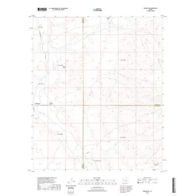
2018 Map of Redington
USGS Topo · Published 2018About this map
Redington stands as the primary settlement in this 2018 study of the high desert where the corners of Pima, Graham, and Cochise Counties meet. The landscape is defined by the northward flow of the San Pedro River, which serves as the central drainage for a complex network of arroyos and canyons. Significant topographic features including Redfield Canyon, Edgar Canyon, and Peck Canyon cut through the terrain from the east and west, illustrating the intricate watershed of the region. Transportation follows the valley floor and ancient natural corridors, with N San Pedro River Rd and Redington Rd providing the principal access points. The convergence of county boundaries here highlights the remote nature of the area, where land management and water rights are often tied to the seasonal flows of Bollen Wash and Soza Wash.
Find a feature on this map
23 named features on this map. Tap any name to fly to it.
Don’t see what you’re looking for? This feature index may not catch every label — zoom into the map to look around manually.
Map Details
Editions of this 2018 Redington Map
This is the sole edition of this map. No revisions or reprints were ever made.
Other maps of this area

1904 · Tucson
USGS Topo · 1:125,000

1905 · Tucson
USGS Topo · 1:125,000

1911 · Winkelman
USGS Topo · 1:125,000

1913 · Winkelman
USGS Topo · 1:125,000

1938 · Galiuro Mts
USGS Topo · 1:48,000

1943 · Galiuro Mts
USGS Topo · 1:62,500

1945 · Redington
USGS Topo · 1:62,500

1948 · Mammoth
USGS Topo · 1:62,500

1948 · Peppersauce Wash
USGS Topo · 1:24,000
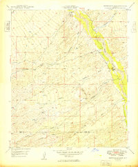
1949 · Peppersauce Wash
USGS Topo · 1:24,000