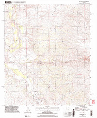
1996 Map of Redington
USGS Topo · Published 2003About this map
The San Pedro River valley defines the character of this landscape, serving as a vital corridor through a territory marked by complex desert hydrology. In the mid-1970s and 1990s, the small settlement of Redington remained a primary focal point for the region, connected by the winding path of Redington Road. The importance of private holdings and agriculture in this arid environment is evident through the inclusion of the Bingham Ranch and Bayless Ranch.
Find a feature on this map
26 named features on this map. Tap any name to fly to it.
Don’t see what you’re looking for? This feature index may not catch every label — zoom into the map to look around manually.
Map Details
Editions of this 1996 Redington Map
This is the sole edition of this map. No revisions or reprints were ever made.
Other maps of this area

1904 · Tucson
USGS Topo · 1:125,000

1905 · Tucson
USGS Topo · 1:125,000

1911 · Winkelman
USGS Topo · 1:125,000

1913 · Winkelman
USGS Topo · 1:125,000

1938 · Galiuro Mts
USGS Topo · 1:48,000

1943 · Galiuro Mts
USGS Topo · 1:62,500

1945 · Redington
USGS Topo · 1:62,500

1948 · Mammoth
USGS Topo · 1:62,500

1948 · Peppersauce Wash
USGS Topo · 1:24,000
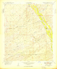
1949 · Peppersauce Wash
USGS Topo · 1:24,000