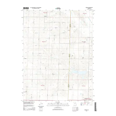
2015 Map of Redman
USGS Topo · Published 2015About this map
The Macon and Shelby County border divides this agricultural landscape, where the northern edge of Clarence meets a network of rural townships. The map reveals a high density of historical family and community burial sites, including the Amish Cemetery along Nova St and the Mitts Cemetery near Orchid St. These locations, alongside Ewing Cemetery and Hawkins Cemetery, suggest a long-established pattern of rural settlement rooted in the 19th-century land divisions. Hydrology plays a central role in the terrain, with Ten Mile Creek and Byar Branch carving through the prairie. To the east, the North Fork Salt River enters the frame, while local water features like Daniel Boone Lake and Wood Lake anchor the central and southern sections. Smaller settlements like Redman and Ten Mile serve as landmarks within this grid of named country roads.
Find a feature on this map
45 named features on this map. Tap any name to fly to it.
Don’t see what you’re looking for? This feature index may not catch every label — zoom into the map to look around manually.
Map Details
Editions of this 2015 Redman Map
This is the sole edition of this map. No revisions or reprints were ever made.
Other maps of this area

1908 · Atlanta
USGS Topo · 1:62,500

1908 · Macon
USGS Topo · 1:62,500

1910 · Macon
USGS Topo · 1:62,500

1953 · Moberly
USGS Topo · 1:250,000

1954 · Moberly
USGS Topo · 1:250,000

1957 · Moberly
USGS Topo · 1:250,000

1958 · Lentner
USGS Topo · 1:24,000

1960 · Moberly
USGS Topo · 1:250,000
1963 · Leonard
USGS Topo · 1:24,000
1964 · Hagers Grove
USGS Topo · 1:24,000