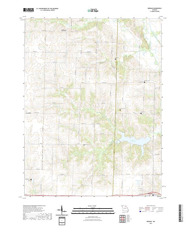
2021 Map of Redman
USGS Topo · Published 2021About this map
The boundary between Macon and Shelby counties defines the central axis of this landscape, where the rural settlements of Redman and Ten Mile anchor a network of agricultural roads and creeks. In the southern reaches, the city of Clarence marks the most developed area, providing a distinct contrast to the northern sections of the map dominated by the winding paths of the North Fork Salt River and Bear Creek.
Find a feature on this map
39 named features on this map. Tap any name to fly to it.
Don’t see what you’re looking for? This feature index may not catch every label — zoom into the map to look around manually.
Map Details
Editions of this 2021 Redman Map
This is the sole edition of this map. No revisions or reprints were ever made.
Other maps of this area

1908 · Atlanta
USGS Topo · 1:62,500

1908 · Macon
USGS Topo · 1:62,500

1910 · Macon
USGS Topo · 1:62,500

1953 · Moberly
USGS Topo · 1:250,000

1954 · Moberly
USGS Topo · 1:250,000

1957 · Moberly
USGS Topo · 1:250,000

1958 · Lentner
USGS Topo · 1:24,000

1960 · Moberly
USGS Topo · 1:250,000
1963 · Leonard
USGS Topo · 1:24,000
1964 · Hagers Grove
USGS Topo · 1:24,000