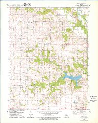
1979 Map of Redman
USGS Topo · Published 1979About this map
The Redman State Wildlife Area dominates the northern reaches of this landscape, situated near the small settlement of Redman. This rural area at the border of Macon and Shelby Counties is defined by a series of north-south running waterways, including the North Fork Salt River and its Old Channel in the northeast, and the expansive Daniel Boone Lake to the south.
Find a feature on this map
32 named features on this map. Tap any name to fly to it.
Don’t see what you’re looking for? This feature index may not catch every label — zoom into the map to look around manually.
Map Details
Editions of this 1979 Redman Map
This is the sole edition of this map. No revisions or reprints were ever made.
Other maps of this area

1908 · Atlanta
USGS Topo · 1:62,500

1908 · Macon
USGS Topo · 1:62,500

1910 · Macon
USGS Topo · 1:62,500

1953 · Moberly
USGS Topo · 1:250,000

1954 · Moberly
USGS Topo · 1:250,000

1957 · Moberly
USGS Topo · 1:250,000

1958 · Lentner
USGS Topo · 1:24,000

1960 · Moberly
USGS Topo · 1:250,000
1963 · Leonard
USGS Topo · 1:24,000
1964 · Hagers Grove
USGS Topo · 1:24,000