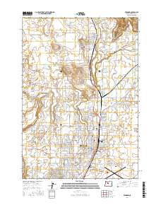
2017 Map of Redmond
USGS Topo · Published 2017About this map
Redmond stands at the center of this 2017 high-desert landscape, showing the city's significant expansion around the junction of Highway 97 and Highway 126. The map reveals a complex water management system essential to Central Oregon, characterized by numerous irrigation channels including Lateral E, Lateral H, and the N Unit Main Canal. These man-made waterways contrast with the natural drainage of the Deschutes River and the dramatic Crooked River Gorge in the northeast corner.
Find a feature on this map
190 named features on this map. Tap any name to fly to it.
Don’t see what you’re looking for? This feature index may not catch every label — zoom into the map to look around manually.
Map Details
Editions of this 2017 Redmond Map
This is the sole edition of this map. No revisions or reprints were ever made.
Other maps of this area

1926 · Bend
USGS Topo · 1:125,000

1929 · Bend
USGS Topo · 1:125,000

1955 · Bend
USGS Topo · 1:250,000

1957 · Bend
USGS Topo · 1:250,000

1958 · Bend
USGS Topo · 1:250,000

1961 · Redmond
USGS Topo · 1:24,000

1962 · Opal City
USGS Topo · 1:24,000

1962 · Forked Horn Butte
USGS Topo · 1:24,000

1962 · Oneil
USGS Topo · 1:24,000
1962 · Redmond
USGS Topo · 1:24,000